Hike into the Rockies
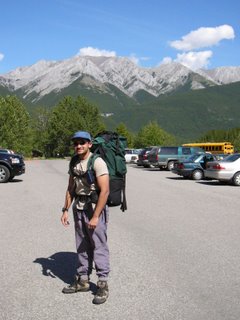
This past weekend, we decided to go for a hike in the mountains. The range of choice, Kananaskis mountain range; and the route in choice was called the Ribbon Falls Trail. We originally wanted to camp at the Ribbon Lake, but due to all the campsites being taken up, we went to Ribbon Falls instead.
Hiking in the Rockies involves parking at various designated parking lots and then hiking up to various trailheads, and then following those trails to various designated campgrounds. The trails are (at least initially) well marked… sometimes though, they do get a bit obscure, which kinda explains why we got lost a bit later. :p
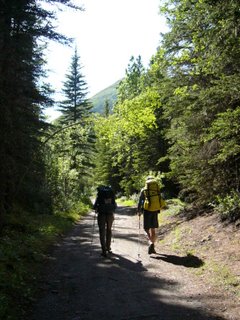
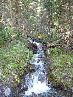
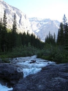
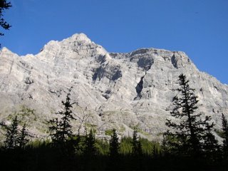
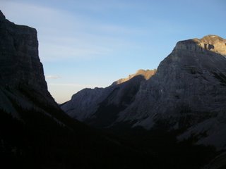
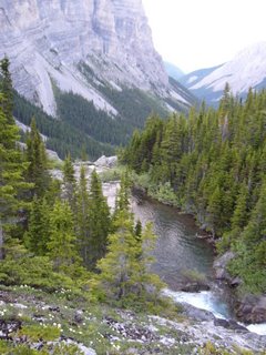
Anyway, the first part of the trail is a wide dirt trail, through some dense conifer forests. Miners and loggers originally used this part of the trail, so it had to be able to haul carts and wagons. Consequently it is wide and the dirt is well packed. Occasionally, we would go across bubbling creeks and rivulets, and sometimes, we would burst through into grassy clearings. Throughout the hike though, there were three constants: Mt Kidd dominating us on the left, Mount Boggart looming over us on the right and the river hurtling down next to us.
The river was more a rapid then anything else. It was fast flowing and clear and there were large boulders inside. Both Mount Kidd and Mount Boggart had ice about halfway to the top. Both are also extremely rocky (well, what else can you expect from mountains in a range called the Rockies). The tree line ends pretty early on for both, and they have very steep faces. The wardens had placed wooden bridges along the path to crossover some of the deeper streams
Eventually, the trail narrows down and becomes more rocky…at some parts, the trail is nothing more than a ledge against the river bank, at others, it is a good three feet wide. All the time, we were going more or less uphill, and though the slope was really gradual, it was still tiring. I hadn’t walked like this in a long while, and though I do jog long distances, walking with a pack on is entirely different. And it brought to mind some (not so fond) memories of army days. Anyway, some 8.5km later we were at the campsite.
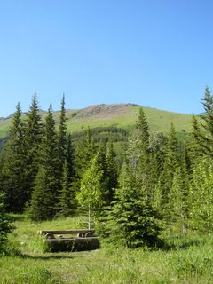
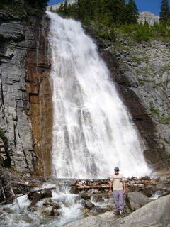
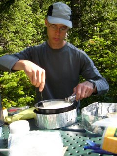
The campsite itself was located right next to a waterfall. It consisted of a group fire pit, which is also the place you eat, and separate a place to pitch your tent. No food is allowed in your tent, as this place is well known for its bears, both black and the much larger brown varieties, and being woken up in the middle of the night by a hungry 300+kg bear with teeth the size of Swiss army knives can be slightly scary. So all food had to be in the bear proof food lockers, which were also present in the campground. We brought along a lot of cheese, dried fruits and nuts, some burgers, ichiban noodles (Singapore Curry flavour…don’t ask me why they were called that…no connection to any dish in Singapore that I had tasted), hot chocolate, tea and Maple whiskey (yum!).
We had the noodles and burgers for dinner (which we had after setting up the tent), and, after washing up the dishes, and refilling our water bottle form the everpresent river, we decided to hike up to the lake on top. It was about 745pm, and the sun was still expected to be out for at least two hours, which should be plenty of time for us to walk the 2.2km to reach the lake, and get back again.
Unfortunately, it wasn’t.
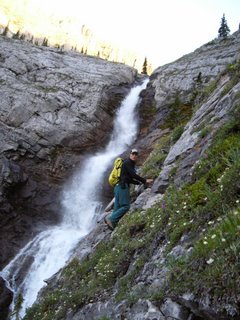
First, the terrain was steeply uphill, and some of it was on really loose and treacherous rocks (scree), so we had to walk really carefully. Next, we got lost: The trail branched of into 2 at a place, and we took the wrong branch, resulting in a sudden dead end. Thinking that the trail was just missing for a bit, Jason and I went to explore, and we did our own impersonation of spiderman (or a mountain goat, depending on which way you look at it). We literally started to go across the face of the mountain, looking for a trail, using handholds and footholds, and with no rope or safety harness. It was a 50+m drop to the rocks below. We gave up after a few minutes, because the going was way too difficult and dangerous. As we made our way back to the fork, we decided to see where the upper trail went, and sure enough, there were some chains in the rock there, put in to help you climb the 5+m of cliff face to the next ledge. On climbing that, we were treated to some spectacular views. However, it was getting dark (940pm) and we were forced to go back to camp, as none of us wanted to go down that chain and cliff with no light… not to mention bears.
We went back to the campground with no further incident, and had some well earned Maple Whiskey (which is just AWESOME…imagine 60 proof alcoholic Pancake syrup). We chatted by the fire, looked at the stars, and then drifted off to sleep in our sleeping bags at 1130pm.
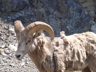
Next morning, we had a breakfast of oatmeal, omelet and tea, took some photos of the waterfall before packing our stuff and heading back to the carpark, which we accomplished in less than 2hrs. It was mostly uneventful, except at the very end, when some mountain goats decided to cross the road. As you can see…we got pretty close to them.
It was one hell of a trip, and I can’t wait to go again. If all goes to plan, I won’t have to wait long, as this week is also a long weekend, and I’m trying to see if I can manage to go down hiking again, but this time, all the way to the top of one of these mountains.
Keeping my fingers crossed!
Desmond, Grace, Wen, this place really reminded me of you. Think you guys would have loved it here.
